Count Waterbirds in the Caribbean – Join our 2025 Region-wide CWC Count!
Do you know of a pond, mangrove swamp, marsh, or beach nearby with waterbirds on it? If yes, we invite you to participate in the 16th annual Caribbean Waterbird Census (CWC). We need your help to monitor more sites and conduct more frequent counts at new and existing sites! The CWC is designed so that at the basic level anyone—from citizen scientist volunteers to professional biologists—can carry out one or more counts and contribute to our knowledge and conservation. Given the hurricanes and droughts which impact our islands nearly every year, it is important to monitor waterbird populations every year to track changes in numbers and diversity. For example, we had reports from our colleagues across the islands of unusual sightings in waterbird diversity and numbers in the 2018 CWC following devastating hurricanes in 2017. Common birds were notably missing from their usual wetlands in some countries, while birds were showing up in large numbers elsewhere. There have been few sightings of waterbirds on Grand Bahama and Dorian following the devastation of Hurricane Dorian in 2019. Help us to determine how birds are doing in the region in 2025!
Link to our shorebird ID resources.
WHERE to Conduct CWC Counts
Waterbirds use many different kinds of wetland habitats. Thus, CWC counts can be conducted in any wetland areas you can access. Wetlands are more than just freshwater swamps and marshes; they include mangroves, salt ponds, lagoons, bays, sandy or rocky beaches, coastal areas, mud flats, tidal flats, rivers, estuaries, canals, sewage treatment plants, and many other places. No matter how big or small, CWC counts from any wetland with waterbirds are valuable. If you have wetlands close by in parks or protected areas, we encourage you to monitor those sites, especially if the wetland is designated a RAMSAR Wetland of International Importance, Important Bird and Biodiversity Area (IBA) or WHSRN site (Western Hemisphere Shorebird Reserve Network). At present, only two wetlands in the Caribbean (Cabo Rojo Salt Flats in Puerto Rico) and Cargill Salt ponds in Bonaire have been designed WHSRN sites but it is highly likely that more sites qualify – we just need the data!
WHEN to Conduct CWC Counts
CWC counts can be done any time of the year. However, we organize one region-wide count in the winter where everyone counts at the same time during the middle of winter (when birds are most stationary) to get a “snapshot” of waterbird population numbers and habitat use throughout the Caribbean. This main count is held every year during a 3-week period from January 14th to February 3rd. These dates include World Wetlands Day on February 2nd, and many participants incorporate CWC counts into their World Wetlands Day events.

There are very large gaps in our knowledge of waterbirds and the sites they use for migration, breeding, and wintering in the Caribbean. Observations during the main CWC count period are very valuable, but only help monitor winter populations. Thus, we strongly encourage you to carry out additional CWC counts at other times of the year (spring and fall migration periods and the summer breeding season) in as many wetland sites as possible. If you can carry out 2 or more, or monthly counts, that’s even better. It is the best way to gather information at the local and regional level about what species are migrating to and through the islands and when, their numbers, and the sites they are using—all vitally important information for conservation and management. As more and more people participate we will be able to provide detailed information on waterbird migration and distributions in the region during all parts of the year. To see our summary report on the first 5 years of census data and the value of the CWC, click here.
HOW to Conduct CWC Counts
The CWC is designed so that everyone can participate. To make this possible, the CWC protocol has been divided into several levels of increasing difficulty with the user choosing the protocol and extent of participation in the program that is best suited to their objectives and available resources. Level 1 counts are the simplest and can be done by anyone.
If you are interested in attempting Level 2 or Level 3 counts, please review the protocols and manual available for download here. It’s perfectly fine if you are just getting started to spend a year getting to know your site (visit and count birds as often as possible!), training your counters, and refining your protocol (how specifically you will count each site), within the general guidelines. However, if you can carry out Level 2 counts (point counts or area searches with some measure of detection probability), that’s even better.
The three types of Level 1 counts are the Point Count, Traveling Count, and Area Search. Forms for recording your data and more detailed instructions can be found here. The eBird Mobile app is a fantastic resource for recording your data in the field (checklists can be submitted when you have internet access later). Be sure to choose the Caribbean portal in your Settings (this will give you access to our Caribbean-specific protocols).
Here are basic instructions on these 3 count methods:
Point Count
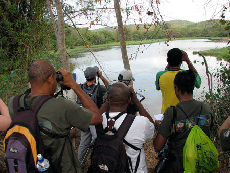
Preparing for your Point Counts: First, visit your pond and decide on the best vantage point (“count station”) to conduct your “point count.” Choose an area that is unobstructed and gives you a good view of birds on the pond. If possible, draw your count area on a map or aerial photo of the site (including both the water and wetland fringe that you are including in the count); Google Earth is a great resource for aerial photos. If your wetland is small to medium-sized (e.g., less than 50 ha), you may be able to count all the waterbirds on it from one or two count stations. If your wetland is large or has lots of vegetation, you may need to carry out counts at a number of stations to cover as much of the site as possible. Place your count stations at least 400 m apart to help avoid double counting (counting the same birds at two stations) Timing: Birds are most active and visible in the morning so do your count between sunrise and about 10 or 11 a.m.
What to do: Arrive at your site quietly and have your binoculars, field guide, notebook and pencil ready. Stand at your count station, record your start time, and count the number of each species that you see on the pond. The recommended duration for the count is 6 to 12 minutes (choose 6, 9 or 12 minutes as your count time). If you need more time to identify and count all the birds, that’s fine, just be sure to record the amount of time you spend counting birds. Try to keep your count time to a maximum of 20 minutes.
Traveling Count and Area Search
Preparing for your Traveling Count or Area Search: If your wetland has a trail, boardwalk or dike running through it, or you want to count a stretch of shoreline, you may choose to do a Traveling Count or Area Search. This involves counting birds while traveling through the wetland (or along the beach) on a set route and counting all birds within your defined area. You should plan the route in advance, based on your knowledge of the area, a map or aerial photograph or a preparatory field visit. Determine the exact area you’ll be covering and make sure that you’ll be able to count all the birds in that area. Finally, if doing an area count: determine how large the defined area is, ACME Planimeter is a good online resource for measuring areas.
What to do: Walk along your route counting all the birds you see in your predefined area. Twenty minutes is typical but your count can be shorter or longer depending on the size of the site and the number of birds. Take care to avoid double counting by keeping track of movements of individual birds and flocks. Draw your count area on a map or aerial photo and be sure to count birds only within this area. Time of day: For both kinds of counts, conduct them in the early morning, sunrise to 10 a.m. Late afternoon is also a good time for counts but avoid the mid-day when most birds go into hiding.
Repeating the same survey over multiple days during the CWC 3-week period will begin to show how variable the birdlife is during this 3-week period and more importantly, will allow for us to also measure detectability (bias) which is extremely important in assessing populations and population changes. Also please remember to repeat these counts every year, following the same methods, during the CWC regional count. We request that you carry out counts as often as possible during the year, especially during fall and spring migration periods and during summer as this will provide more valuable data on the importance of the site for migratory and breeding resident species.
Entering Your Data
Finally, visit eBird , where you can enter your bird count data for any country in the Caribbean. From the main page, click the “Submit Observations” button near the top. If you are new to eBird , you will then need to create a free account. Instructions on how to submit an eBird checklist can be found here. To enter your CWC data, create a checklist for each point count or area search. When entering a checklist for a new location, make sure that you find the exact location on the map. Also, on the Step 2 “Date and Effort” page, be sure to choose either the “CWC Point Count” or CWC Traveling Count” or “CWC Area Search” observation type to enter your data.
Do your best to count and record ALL species in your count area (including land birds) and record your effort (the amount of time spent counting), so that you can submit a “complete checklist” to eBird —this data is much more valuable. If you prefer to enter your count data via an Excel spreadsheet, please use this file: ebird_upload_cwc-rev, which shows sample data entered for the 3 types of counts. Helpful instructions for importing data via spreadsheets are posted here.
On the eBird website, you can enter, save and explore your bird observations in graphs and on maps as well as compare your site with other sites around the Caribbean. This database is an invaluable tool for birders, scientists, natural resource managers and conservationists.
If you have any questions whatsoever or want us to review your plans, don’t hesitate to contact us. Also, if you need help getting started in eBird Caribbean, let us know (email Alex Sansom, our Waterbird Program Manager).
Finally, bring a digital camera in the field with you—if you are unsure of the identification of any of the birds you are seeing, don’t guess! Send us your photos and we will do our best to help (Send your photos to our Waterbird Working Group Discussion group and it will be good ID practice for all of us—shorebirds can be challenging to even very skilled birders!!!). Please post your photos also to our Flickr group, Caribbean Bird ID – Monitoring, to help us build this reference library! Below are links to many great resources to help you conduct CWC counts as well as information on how to contact us.
Sightings of Marked Birds

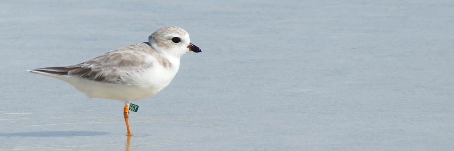
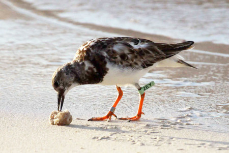
Be on the lookout for banded birds! The Caribbean provides important migration stopover and wintering habitat for a number of birds; we can contribute data on the locations and habitats used by these birds. In particular, look for bands on Ruddy Turnstones, Piping Plovers, Red Knots, Sanderlings, Semipalmated Sandpipers, and American Oystercatchers. Do your best to note the color and position of each band on the bird (e.g., right leg, left leg, upper and lower) and read any letters or numbers on the bands. For more information on species that have been banded and to report banded birds, visit the Shorebird Banding and Resighting Website. Magnficent Frigatebirds with Wing Tags – Sarah Trefry, graduate student at the University of New Brunswick put wing tags on frigatebirds in Barbuda. These birds are being spotted all over the Caribbean. If you see marked birds, please report them to Sarah (sarah.trefry@gmail.com). Great Egrets with wing tags and colored legbands – More than 1,500 Great Egrets have been color-marked in Ontario and resighting data shows that about 20% are wintering in the Caribbean. Read more about this project here. Send your sighting of marked birds to Chip Weseloh (Chip.Weseloh@ec.gc.ca).
International Shorebird Survey (ISS)
Is your survey site particularly good for shorebirds? If yes, then please share your count data with Manomet (an organization dedicated to shorebird conservation) – it’s easy to do this! After uploading your data to eBird Caribbean (using the CWC protocol on Step 2), share the checklist with the username “ISSData” which will flag the count as a joint ISS count for the folks at Manomet. In addition, we would like to invite you to schedule some extra counts during the migration season in the Caribbean and with that, become a volunteer for the International Shorebird Survey (ISS). Read more about how to participate in the ISS at this link.
Additional Notes
Help and assistance: If you have questions don’t hesitate to contact Alex Sansom, Lisa Sorenson or Jeff Gerbracht. Data forms: Forms for recording your count data and more detailed instructions for conducting the count are available in this file. More on the CWC: The CWC was established by BirdsCaribbean to promote conservation and monitoring of resident and migrant waterbirds and their wetland habitats in the insular Caribbean (including Bermuda and Trinidad and Tobago). Its objectives are to:
- Promote inventories, surveys and censuses of waterbirds and their habitats in all Caribbean countries,
- Monitor changes in waterbird numbers and distribution,
- Improve knowledge of little-known waterbird species and wetland sites,
- Encourage broad-based participation in waterbird counts including NGOs, governmental agencies, institutions, communities and volunteers,
- Ensure that as many internationally and nationally important sites as possible are conserved and monitored, and
- Increase awareness of conservation issues related to waterbirds and their wetland habitats at local, national and international levels, and what can be done to address these issues.
The CWC offers a hierarchical and flexible approach to monitoring (employing levels of monitoring) that enables the user to choose the protocol and extent of participation in the program that is best suited to their objectives, available resources and capacity. The basic CWC counts described here (Level 1 counts, area search and point count) are recommended for basic counts and site inventories. CWC Level 2 protocols are similar to Level 1 but include measures of detection probability, which are essential for accounting for bias in monitoring. Through this program, the Caribbean region will join Wetland International’s global program of wetland bird monitoring, with data from the Caribbean filling a major gap in the coverage of the International/Neotropical Waterbird Census. It can be used to promote site conservation, assess impacts of climate change and other threats on waterbirds and wetlands, and design programs to protect, manage and restore wetlands.
